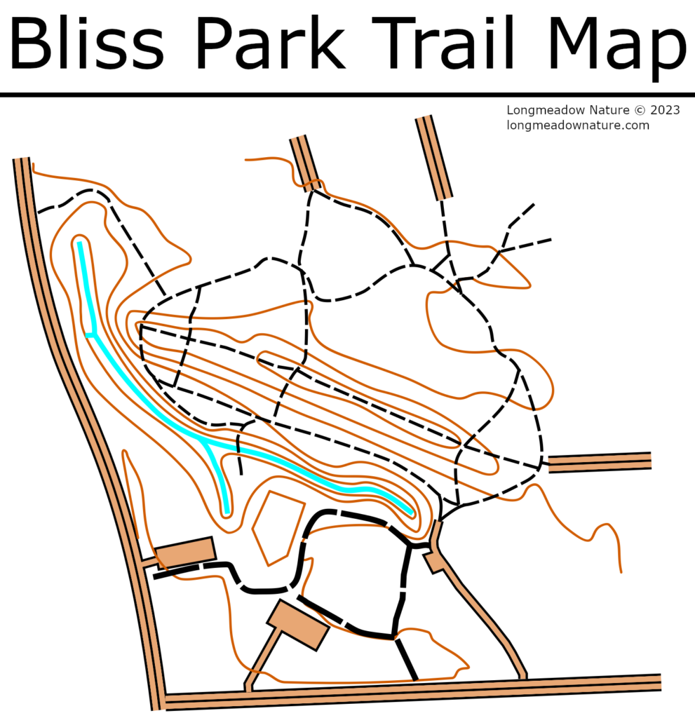
I made a trail map of Bliss Park! I will do Laurel Park, Turner Park, and the meadows next. I did not feel the need to add trail names to Bliss, the only “official” names might be the Main Loop and Ridge Line Trail. Bliss Park has no real trail management. New trails are created by folks who feel like making one. Trail density is high, trail erosion is a problem, and many old trails keep widening rather than being maintained. Hopefully in the future this map can be simplified to have only a few good trails.
Dear Neighbor
May I have permission to post this on the Save Bliss Park Facebook page and also on Instagram. Thanks for sharing this!
Betsy Port
Yes feel free to openly share!!
I am trailmap disadvantaged- could you explain the different lines?
Very good point! In the future hopefully I include a key/legend but unfortunately the software I am using cannot automatically generate this. I used the ISOM 2017-2 “International Specification for Orienteering Maps” and you can find specific details at this link https://omapwiki.orienteering.sport/specifications/isom/
But basically the blue is the brook, orange is contour lines (2 meters), orange with black around it is roads/parking, thick dotted is the asphalt path, small dotted are the trails in the forest.